

GIS & Aerial Mapping Services in Utah
Clear spatial information for confident land decisions
Seeing your land from above — and understanding how its features interact — changes how decisions get made.
Alpine Forestry provides integrated aerial data collection and geospatial analysis to turn complex spatial information into clear, usable insight. Our work supports wildfire mitigation, land management, planning, and long-term stewardship for landowners, HOAs, agencies, and project teams across Utah — helping decisions happen before work begins.

What This Service Supports
Clients rely on our mapping and geospatial services to:
Plan wildfire mitigation and defensible space projects
Manage large or multi-parcel properties
Evaluate forest health, vegetation patterns, and exposure
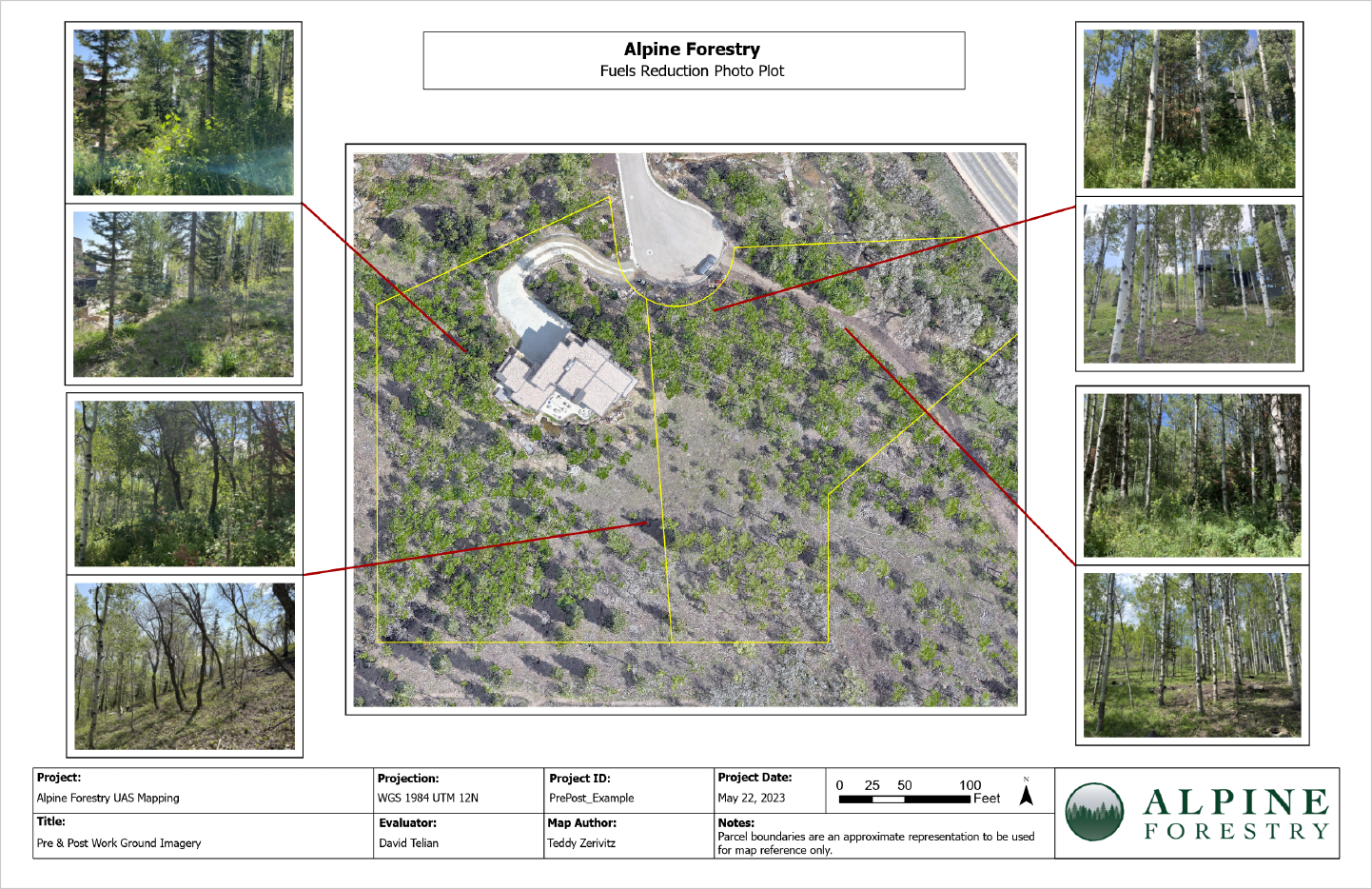
Document site conditions before or after land management work
Support reporting, grants, or compliance requirements
This service provides clarity at scale — showing how conditions, risk, and terrain interact across the landscape.
Integrated With On-the-Ground Work
Because Alpine Forestry plans and performs wildfire mitigation, land management, and arborist work, we understand how terrain, access, vegetation, and equipment affect projects. That field experience shapes how data is collected, analyzed, and presented.
The result is spatial insight that matches reality, supports crews, and translates cleanly from screen to site.

Aerial Mapping: Learn Your Land
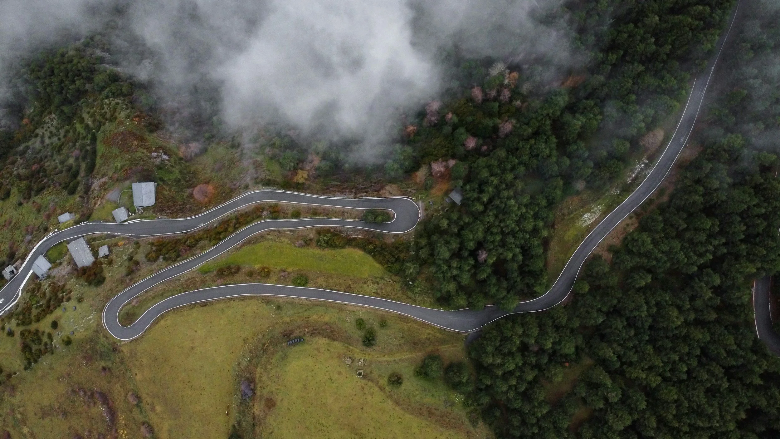
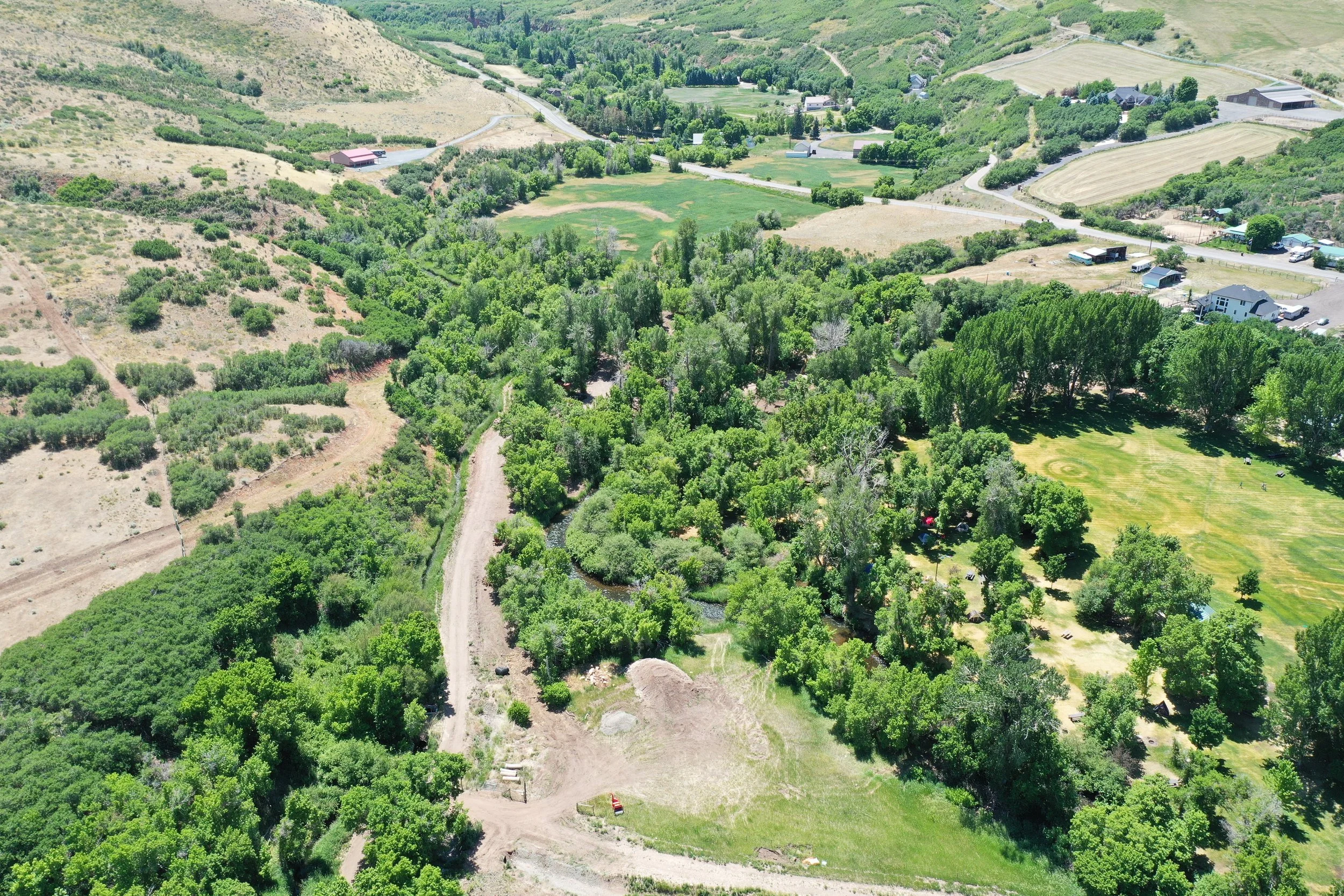
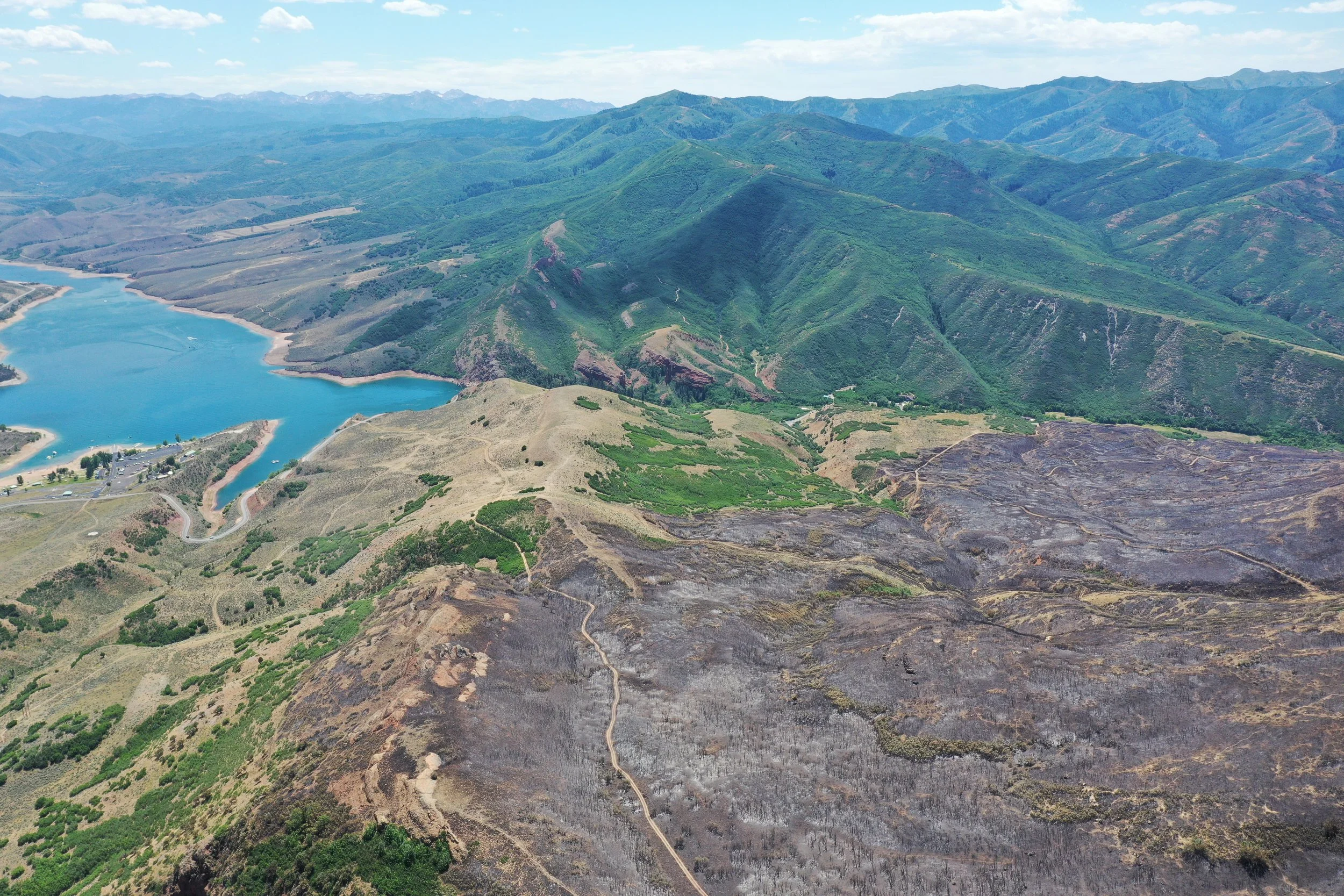
Aerial data provides a perspective that is difficult — and often impossible — to capture from the ground alone.
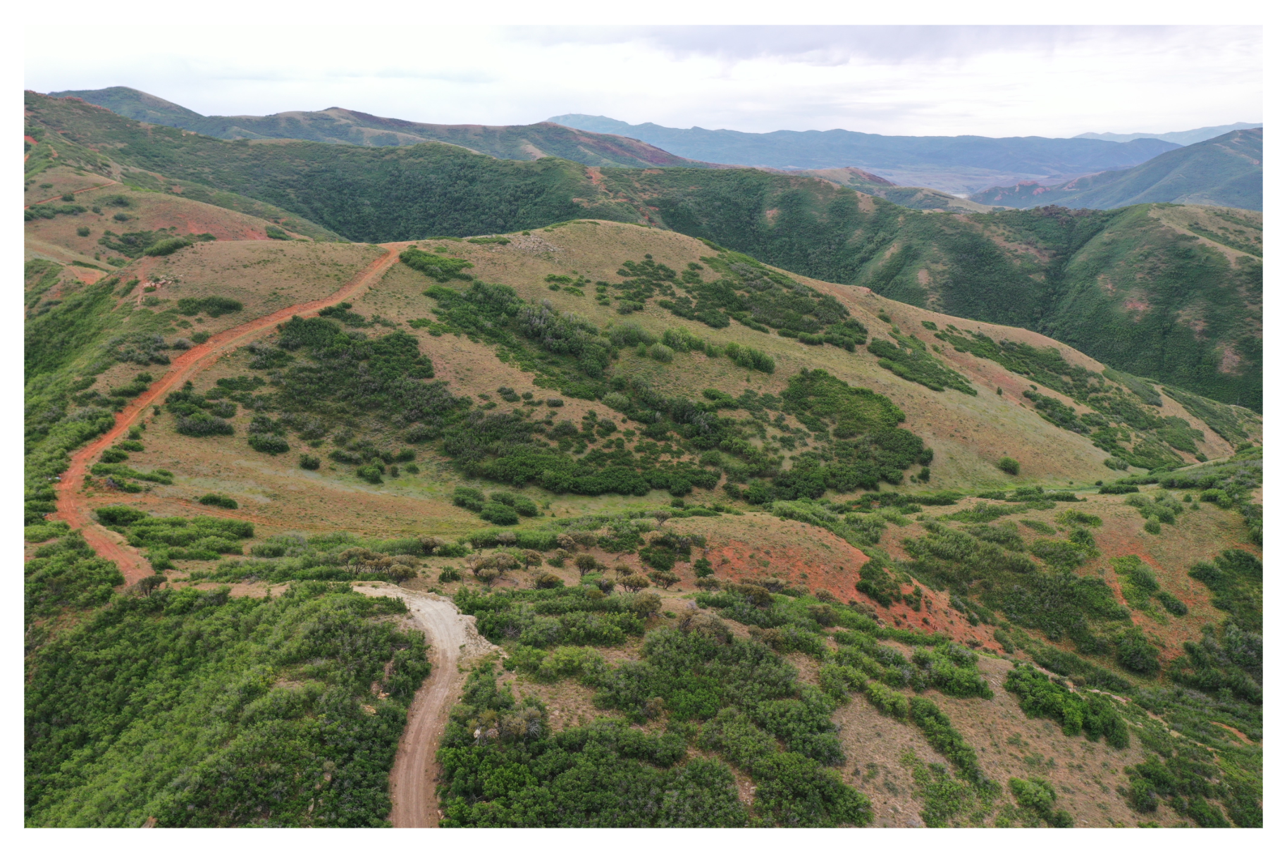
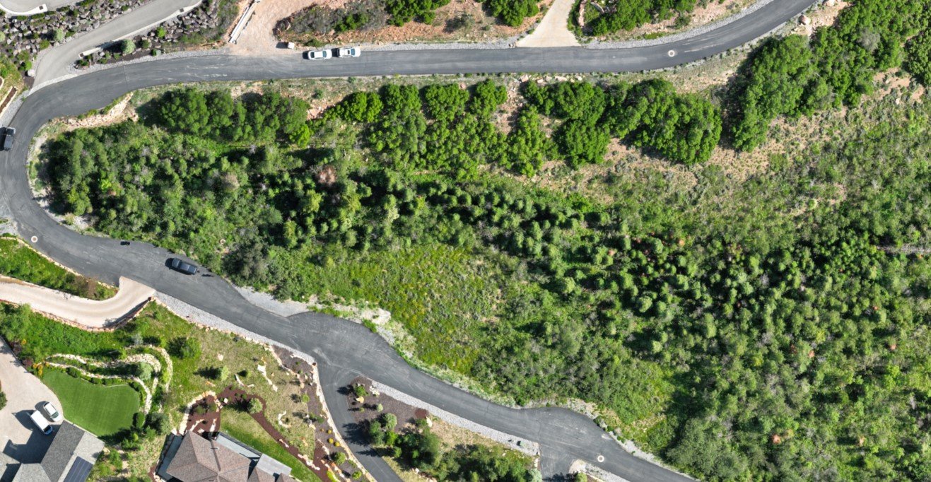
We collect imagery using unmanned aerial systems (drones) and tasked satellite imagery, depending on project needs, scale, and access.
Understand vegetation patterns and fuel continuity
Monitor change over time
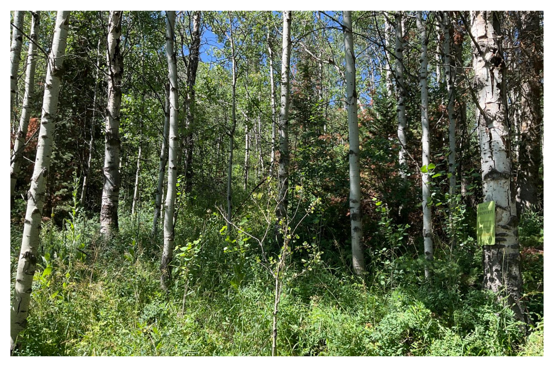
Document existing conditions before work begins
Support long-term land and forest management planning

GIS & Remote Sensing Capabilities
Our GIS work combines field knowledge with modern spatial analysis to deliver practical, decision-ready results.
Natural resource remote sensing and data analysis
UAS-derived terrain and surface modeling
GIS mapping and analysis using ESRI ArcGIS®
Web-Based Mapping & Cartography
When information needs to be shared, updated, or viewed collaboratively, we develop web-based GIS maps that are accessible and easy to use.


Aerial Mapping Capabilities
Our aerial data products are measured, referenced, and applied directly to planning and implementation.
Capabilities:
High-resolution landscape imagery
Geo-referenced orthomosaic maps
Digital elevation and surface models
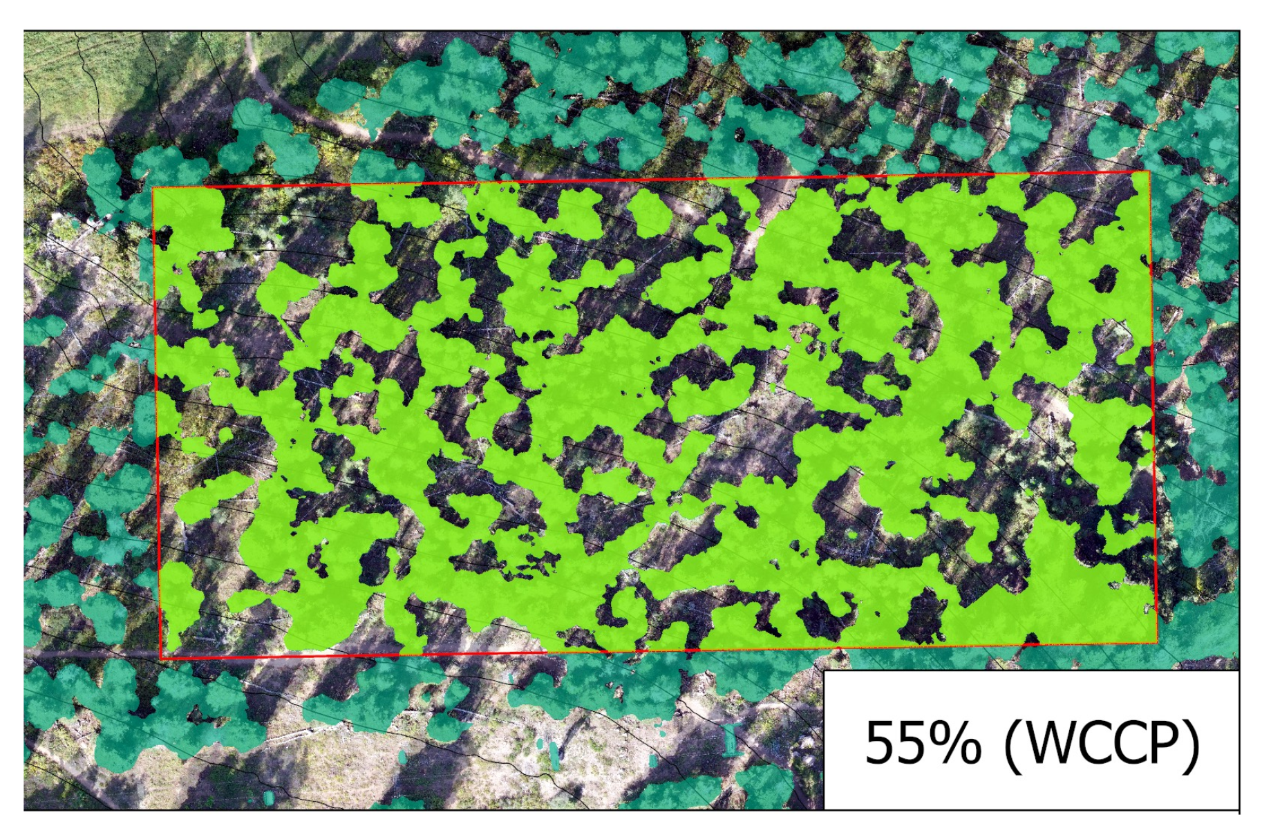
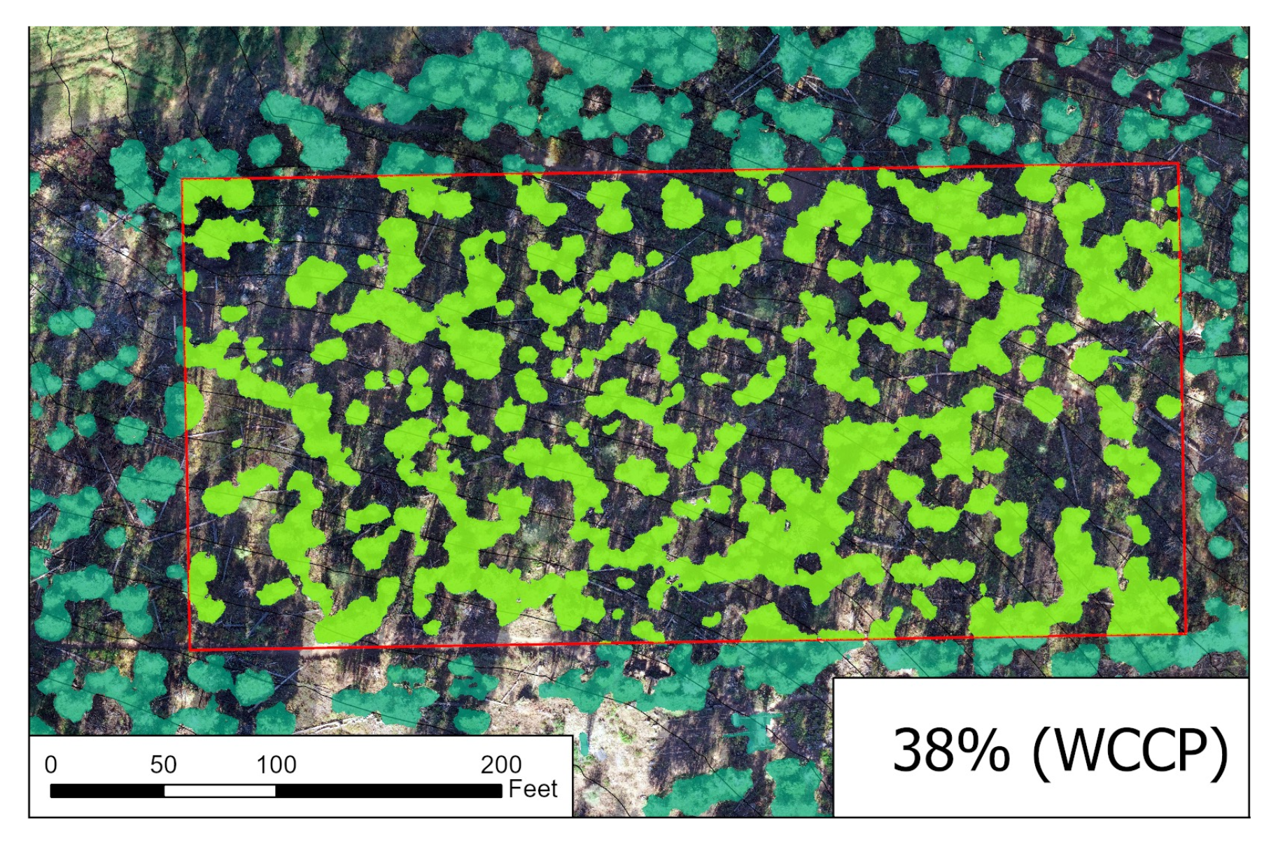
Forest structure and vegetation modeling

How Aerial Mapping Is Applied
We apply aerial mapping across a wide range of forestry and land management needs, including:
Burn pile counts and documentation
Vegetation and tree distribution analysis
Forest health monitoring
Structural and landscape change documentation
Stem counts and density estimates
Wildfire mitigation and defensible space planning
Conservation easement and compliance monitoring
Fast, accurate data collection allows projects to be scoped correctly and managed efficiently — especially on large or complex properties.

How GIS Supports Planning & Management
GIS reveals relationships that aren’t visible on the ground — how terrain, vegetation, infrastructure, and risk interact across a property or community.
We use GIS to:
Analyze forest structure and fuel patterns
Evaluate wildfire risk and defensible space needs
Support land management and conservation planning
Track change over time
Communicate complex information clearly

A Practical Approach to Complex Data
We focus on producing GIS and mapping products that are:
Clear and easy to interpret
Directly tied to project goals
Appropriate in scale and detail
Useful beyond a single moment in time

Start With a Conversation
If GIS or aerial data could improve planning, coordination, or outcomes for your project, we’ll help determine the right approach and how it fits into a larger land management plan.